I Walked the Alta Via 1 in 6 Days. My Knees Have Filed a Complaint.
A personal six-day Alta Via 1 story through the Dolomites, with route notes, hut memories, weather, practical lessons, and the trip that sparked Zew Studio.
A route-memory hero inspired by the six-day Alta Via 1 line through the Dolomites.
Key takeaways
- Six days on the Alta Via 1 is possible, but it turns a classic hut-to-hut trek into a serious mountain effort.
- Hut availability, summer transport rules, route variants, and weather can shape the trip as much as fitness.
- The route became the first Zew Studio poster idea because the Strava line carried the memory better than a generic souvenir.
What I really wanted was not just a souvenir of the Dolomites. I wanted a memory of my route.
The Alta Via 1 is one of those hikes that sounds romantic when you are sitting at home with a coffee.
"A beautiful hut-to-hut route through the Dolomites," they say.
"Classic," they say.
"Accessible," they say.
And yes, it is beautiful. It is classic. It is one of the most spectacular long-distance routes in Europe. But if you decide to walk the whole thing in six days, it also becomes a very efficient machine for turning your legs into warm pasta.
I walked the Alta Via 1 in August, starting at Lago di Braies and finishing at La Pissa six days later before taking the bus toward Belluno. It had everything: perfect weather, horrible weather, cold lakes, hot climbs, wet shoes, excellent dinners, questionable route decisions, one exposed via ferrata descent I probably should not have done without gear, and enough dramatic limestone scenery to make your phone storage quietly give up.
This is both a personal story and a practical guide. It is also, in a quiet way, the reason this website exists. The Alta Via 1 is absurdly poster-friendly: the shapes, the ridgelines, the huts, the lakes, the little line of a trail cutting across enormous mountains. It all looks designed.
But mostly, this is the story of walking through the Dolomites for six days and occasionally wondering whether I had made a sensible life choice.
What Is the Alta Via 1?
The Alta Via 1 is a long-distance hiking route through the Italian Dolomites. It starts at Lago di Braies, also known as Pragser Wildsee, and heads south through some of the most famous mountain scenery in the region.
It is usually walked as a hut-to-hut trek, meaning you sleep in rifugios along the way rather than carrying camping gear. That sounds luxurious, and sometimes it is. Sometimes you get a brilliant dinner, a warm bed, and a mountain view that makes you briefly forget the price of everything in the Dolomites.
Other times, your socks are wet, the dormitory is damp, there is no heating, and everyone in the room smells like a waterproof jacket that has lost the will to live.
The usual itineraries take longer than six days. Many people split it into around 7 to 12 days, depending on pace, hut availability, route variations, and how much they enjoy having functioning knees. I did it in six, which made the trip intense but very memorable.
Would I recommend six days? Yes, if you are fit, comfortable with long mountain days, and happy to suffer a little.
Would I recommend it as a relaxing holiday? Absolutely not. Go to Lake Como and order an Aperol Spritz like a normal person.
Why I Wanted to Walk It
I wanted a route that felt like a proper journey.
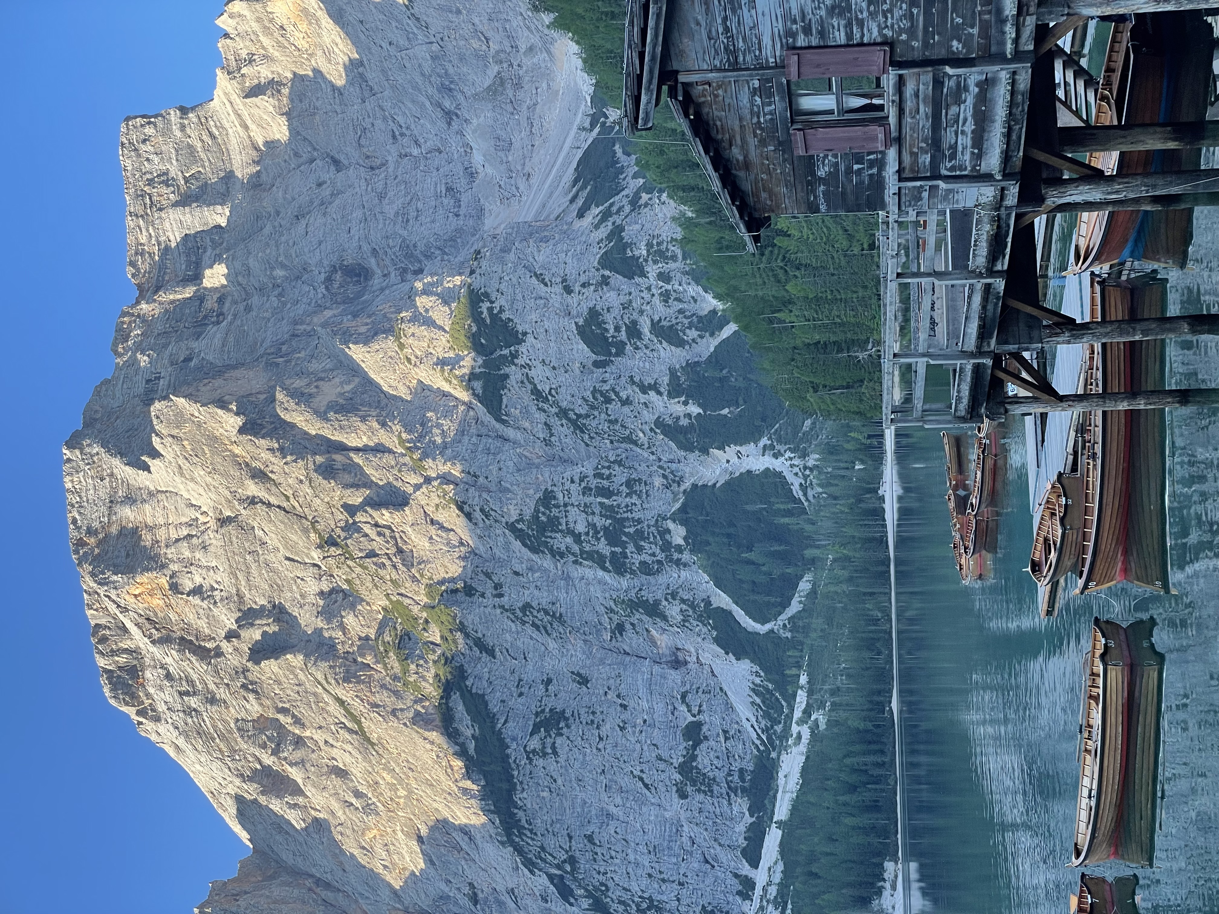
Not a single summit. Not a day hike. Not a "walk for three hours and have cake" situation. I wanted something with a beginning, a middle, and an end. Lago di Braies gives the route a very obvious opening scene: turquoise water, cliffs, tourists, boats, and the sense that you are about to leave the postcard and walk into the mountains behind it.
The Alta Via 1 also has a strong visual identity. For poster design, that matters. Some places are beautiful but visually messy. The Dolomites are not like that. They have huge shapes, clean silhouettes, towers, ridges, valleys, huts, and lakes. They look graphic before you even start simplifying them.
So I went partly for the hike, partly for the memories, and partly because I knew the route would eventually become a poster.
Also, apparently, because I wanted to discover exactly how wet a shoe can become before it qualifies as a portable swamp.
How I Got to the Start
My route to the start was not especially glamorous, but it worked.
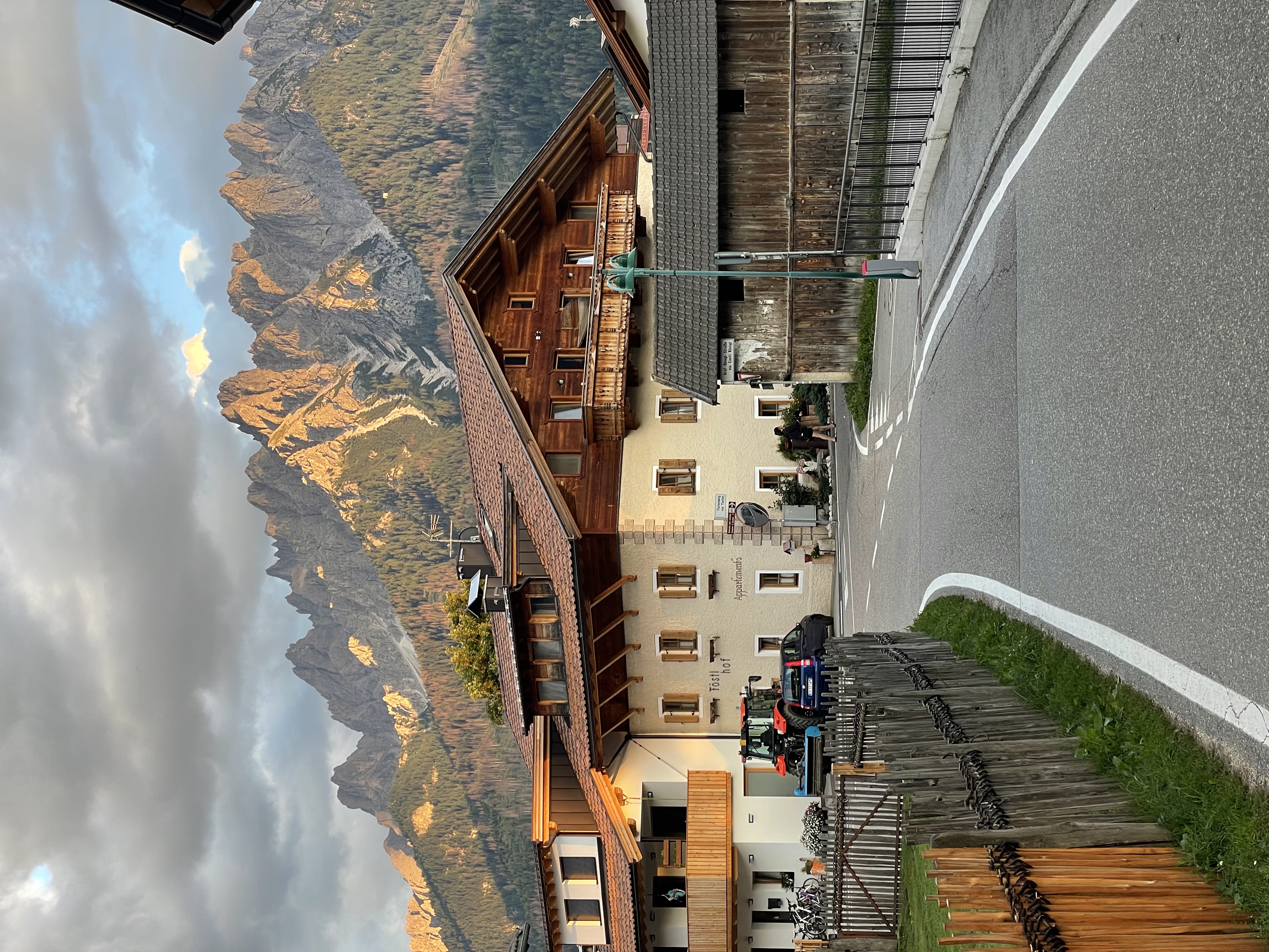
I first went to Cortina d'Ampezzo, then made my way to Dobbiaco/Toblach, where I stayed before starting the route. The next morning, I took the bus from Toblach toward Lago di Braies / Pragser Wildsee, which is the classic starting point of the Alta Via 1.
This is important: if you are planning the Alta Via 1 in summer, do not treat transport to Lago di Braies like some casual village bus where you simply appear with a backpack and optimism. In high season, access can be controlled, and buses may require advance booking or reservation. Check the current rules before you go.
The basic idea is usually:
- get yourself to the northern Dolomites
- stay near Dobbiaco/Toblach, Villabassa/Niederdorf, or somewhere with a good bus connection
- take the bus to Lago di Braies
- start walking before the lake gets completely swallowed by tourists and selfie sticks
Lago di Braies itself is stunning, but it is also busy. Very busy. It is one of those places where nature and Instagram have had a terrible argument and both won.
The good news is that once you start climbing away from the lake, the crowd changes. The casual visitors disappear, and the trail begins.
My 6-Day Alta Via 1 Route
This was my six-day itinerary:
| Day | Route | Distance | Moving Time | Elapsed Time | Elevation Gain |
|---|---|---|---|---|---|
| 1 | Lago di Braies to Rifugio Lavarella | 23.5 km | 5h 30m | 6h 45m | 1,621 m |
| 2 | Rifugio Lavarella to Rifugio Averau | 24 km | 6h 06m | 7h 33m | 1,650 m |
| 3 | Rifugio Averau to Rifugio Passo Staulanza | 18.5 km | 5h 00m | almost 7h | 700 m |
| 4 | Rifugio Passo Staulanza to Rifugio Mario Vazzoler | 19.08 km | 4h 53m | 5h 53m | 1,221 m |
| 5 | Rifugio Mario Vazzoler to Rifugio Sommariva al Pramperet | 23-24 km | 6h 00m | 7h 20m | 1,360 m |
| 6 | Rifugio Sommariva al Pramperet to La Pissa | 20 km | 4h 52m | 5h 30m | 866 m |
This was not a gentle version of the Alta Via 1. It was more like taking the normal route, compressing it, and then asking your body to please behave.
Sometimes it did.
Sometimes it sent formal complaints.
Day 1: Lago di Braies to Rifugio Lavarella
The first day started at Lago di Braies.
This is the classic beginning of the Alta Via 1, and it is a very dramatic place to start. The lake is beautiful, but it is also busy, so there is a slightly strange feeling at the beginning. You are standing among tourists, cameras, boats, and neat shoes, while you are carrying a backpack and preparing to walk across the Dolomites.
Then the trail climbs away from the lake, and the trip properly begins.
My first day was 23.5 kilometers. Moving time was about 5 hours and 30 minutes, with an elapsed time of 6 hours and 45 minutes. As a warm-up, this was not so much a warm-up as a formal declaration of war.
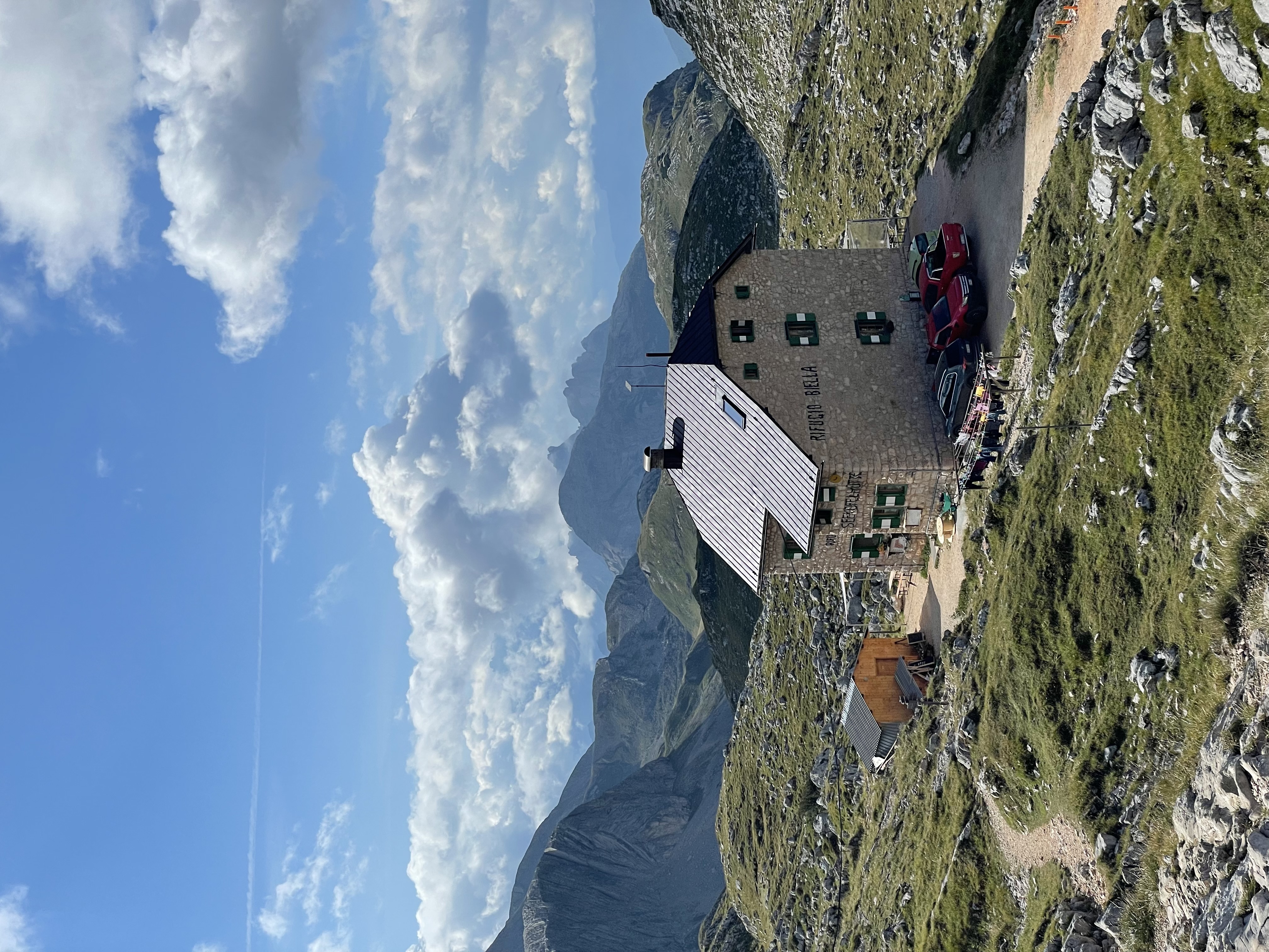
The first big marker was Rifugio Biella / Seekofelhütte, near Croda del Becco. This is where the lake-and-tourists part of the day gave way to proper mountain business. Less "look at the pretty water." More "why is the path still going up, and who authorised this?"
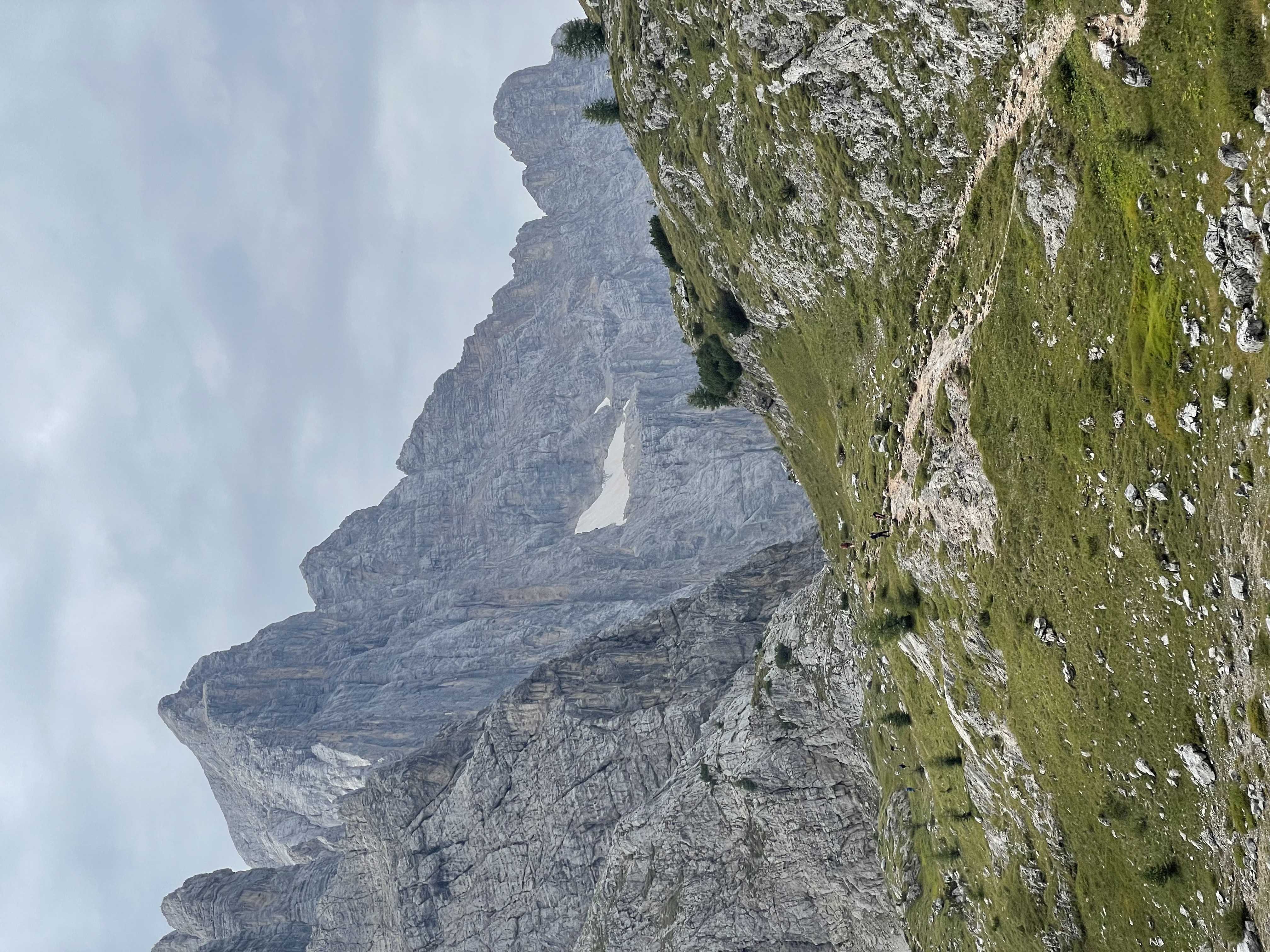
From there, I moved from the Braies area toward the Fanes region. The landscape started to feel wider and stranger, like the mountains had stopped being scenery and become a whole kingdom. Which, in a way, they are: the Fanes plateau is tied to Ladin legend, and it does have that mythic quality. A lost mountain realm. Pale rock. High grass. Ancient stories.
Also me, sweating through a T-shirt and calculating whether my snack supply had the strategic depth of a small country.
I had originally hoped to stay at Rifugio Fanes, but I could not find accommodation there, so I stayed at Rifugio Lavarella instead.
That turned out to be a very good thing.
The weather was amazing. Bright, clear, properly Dolomites-in-August weather. The kind of day where every rock formation looks like it has been placed there by a slightly theatrical architect.
Near Rifugio Lavarella is Lago di Le Vert, a small alpine lake. After walking 23.5 kilometers, I took a quick dip in it.
This was one of the perfect moments of the trip. Cold water, tired legs, mountain air, and the feeling that the whole journey had properly started.
You can plan routes and book huts and check distances, but sometimes the memory that stays with you is just this: arriving tired, taking off your boots, and stepping into a cold lake in the Dolomites.
Day 2: Rifugio Lavarella to Rifugio Averau
The second day started early. I had breakfast at around 7:30 and left at about 8.
This was one of the hardest days of the trip. I walked 24 kilometers, with 6 hours and 6 minutes of moving time and 7 hours and 33 minutes elapsed. The elevation gain was around 1,650 meters, which is a large number when you are actually the person doing it.
The weather was beautiful again, but very warm. There is a special kind of mountain suffering that happens when the views are perfect but your body is overheating. You cannot even complain properly, because everything around you looks magnificent.
I was not feeling especially well that day either, so the heat, distance, and climbing combined into one large personal problem.
The route from Lavarella toward the Lagazuoi and Averau area is spectacular, but it also has some serious sections. One of the most memorable was Forcella del Lago. Coming from the Lavarella side, you climb up toward the pass and then descend steeply toward Lago di Lagazuoi.
This is not a section I would tell people to avoid. In good conditions, with decent legs and a sensible head, it is part of the route's drama. But it is absolutely a section to respect. Loose, steep, and exactly the sort of place where your knees start sending text messages to your brain saying, "Why are we here?"
After that, I continued through the Lagazuoi area. It is not just beautiful; it is also full of First World War history, tunnels, and open-air museum material, because apparently the Dolomites decided that being spectacular was not enough and added a war documentary as well.
I did not go through the Lagazuoi tunnels because I am a bit claustrophobic, and the idea of voluntarily walking into a mountain after already walking a very long way did not appeal to me.
So instead, I climbed up to Rifugio Lagazuoi and then toward the peak next to it for the view.
Was this wise, given that I was already tired?
No.
Was it worth it?
Completely.
The view was huge. The best of the whole trip. One of those Dolomites panoramas where the landscape does not reveal itself politely, it detonates: ridges, towers, pale stone, and enough jagged theatre to make every ordinary hill in Britain look like a sleeping bag under a carpet.
I was exhausted.
I was also very happy.
Later, I had wanted to go to Rifugio Scoiattoli, but I skipped it because it was getting late and I wanted to reach my hut. This is one of the realities of a six-day Alta Via 1 itinerary: you cannot do every detour, every viewpoint, every hut, every coffee. Sometimes you have to be boring and sensible.
I finished at Rifugio Averau.
The food on the whole trip was a highlight, but dinner at Averau was the champion. After a hot, long, tiring day, it felt like civilisation had been invented specifically for me, put on a plate, and carried over by someone who understood that morale is mostly carbohydrates.
Day 2 was the effort day: big distance, big heat, big elevation, steep descent, huge views, and a dinner that arrived like a religious experience.
Day 3: Rifugio Averau to Rifugio Passo Staulanza
Day 3 started early again from Rifugio Averau.
On paper, this was almost a rest day compared with the previous two. I walked 18.5 kilometers, with about 5 hours of moving time and almost 7 hours elapsed. Elevation gain was around 700 meters, which sounded friendly.
This was misleading.
The day began with the route up to Rifugio Nuvolau, which sits at around 2,575 meters. The views from there were fantastic. Proper "stand still and stare" Dolomites scenery.
Then came the descent.
The equipped section was Ferrata Ra Gusela al Nuvolau. On paper, it is generally considered an easy ferrata. That is a useful fact if you are fresh, prepared, wearing the right gear, and not trying to descend it with a backpack after several large mountain days.
I was none of those things.
I had seen only a small mention of it beforehand, and I had no via ferrata gear. No helmet. No harness. No set. Just me, my backpack, and an amount of confidence that, in hindsight, may have been imported from a different and more foolish person.
The descent was steep and exposed. There was a vertical ladder in the middle. I was scared as hell.
I climbed down anyway.
This is the part where I should be very clear: I am not recommending this. If your route includes a via ferrata section, check it properly and bring the right equipment. The Dolomites are not a theme park. They are mountains, and occasionally they remind you of this in a very direct tone of voice.
Once I got down, I had a massive adrenaline rush. Later, there was another smaller ferrata-style section, but it did not feel as exposed. Along the way, I met other hikers, most of them going up with helmets and proper gear. Several of them told me, more or less, that I was an idiot.
They were probably correct.
But there was also a bit of respect in their reaction, which I will accept, because after descending an exposed section without gear, you take whatever emotional reward is available.
After that, the day finally stopped trying to remove me from the mountain and went back to being a hike.
From the Nuvolau area, I continued down toward Passo Giau, which felt almost civilised after the ferrata drama. Almost. The mountains were still enormous, the sun was still doing its best impression of an industrial heater, and my legs were still behaving like badly managed public services.
From there, the route moved on through the Forcella Giau and Forcella Ambrizzola area, with the huge shapes of Ponta Lastoi de Formin and Becco di Mezzodi nearby. This was the part of the day where the scenery became wide and open again: less ladder-based terror, more classic Dolomites theatre.
I skipped Rifugio Croda da Lago, because this was a six-day itinerary and therefore every nice detour had to submit a formal application to my legs.
Most applications were rejected.
The trail then carried on toward Rifugio Città di Fiume, with Monte Pelmo becoming the big landmark of the afternoon. Pelmo is nicknamed God's armchair, and once you see it, that makes complete sense. It is less a mountain and more a divine stone sofa, parked at the end of the day by someone with a flair for dramatic furniture.
From there, I continued toward Rifugio Passo Staulanza. It was warm again, but because the elevation gain was lower, the day felt physically easier than Day 2.
I finished at Rifugio Passo Staulanza.
And there was a sauna.
Not a giant luxury spa with someone handing you cucumber water and asking about your chakras. More like a mountain-hut version of a spa. But after three days of walking, it felt spectacular. Wet sauna, dry sauna, warmth, recovery, the illusion of being a normal human again.
Day 3 was the adrenaline day. A beautiful start, a terrifying descent, and then the deep joy of arriving somewhere with heat.
Day 4: Rifugio Passo Staulanza to Rifugio Mario Vazzoler
Day 4 had a completely different mood.
I started from Rifugio Passo Staulanza and walked through the forest toward Palafavera. After the exposed drama of the previous day, beginning in the trees felt calmer. The weather was cloudier, and the top sections were not clear, which was a shame, but it also gave the day atmosphere.
From Palafavera, I climbed toward Rifugio Adolfo Sonino al Coldai. Much of the climb was in the clouds. This is slightly annoying when you know there should be enormous views around you, but it is also quite beautiful in its own way. The mountains appear and disappear, and you walk through a world that feels half-hidden.
The day was 19.08 kilometers, with 4 hours and 53 minutes moving time and 5 hours and 53 minutes elapsed. Elevation gain was 1,221 meters, so it was still a real mountain day, even if it felt less brutal than the first three.
When I reached Lago Coldai, the weather started to improve. I did not swim there, but the view was great. The clouds began to move, and the lake appeared with that dramatic mountain-lake timing that makes you forgive the weather for being irritating earlier.
From there, I continued around the Civetta massif and climbed to Rifugio Attilio Tissi.
This was one of the best stops of the day. The view down toward Alleghe and Lake Alleghe was fantastic. It also meant something personal to me because I used to ski there. Seeing the same area from above, in summer, after days of hiking, felt strange and cool.
It is a good feeling when a place you know from one part of your life suddenly appears in another form. Alleghe was not just a dot in the valley. It was familiar, but from a completely new angle.
I had lunch at Rifugio Tissi, then continued toward Rifugio Mario Vazzoler.
The final part of the day felt damp. It was not properly raining, but the air was wet, and my feet were a bit wet too. I do not remember exactly whether it was from the path, grass, humidity, or some minor personal failure in waterproofing. Probably all of the above.
Rifugio Vazzoler itself felt a bit damp too. There was no real heating, so it was not the warmest place. But the dinner was amazing, and the view was magnificent.
From the hut, I had a view toward the towers around Civetta, including Torre Trieste and Cima della Busazza. That view made the dampness easier to forgive.
Day 4 was the atmospheric day: forest, cloud, Coldai, the Alleghe view, damp boots, great food, and the big rock towers around Vazzoler.
Not every mountain day has to be blue sky and heroic poses. Sometimes it is better when the clouds move around a bit and make the mountains look slightly dangerous.
Day 5: Rifugio Mario Vazzoler to Rifugio Sommariva al Pramperet
Day 5 was grim.
I do not mean "a little cloudy." I mean properly grim. Rain, wind, wet shoes, thunderstorm energy, and the general atmosphere of a Scandinavian crime drama, except with more elevation gain.
The day was around 23 to 24 kilometers. Moving time was about 6 hours, and elapsed time was 7 hours and 20 minutes. Elevation gain was around 1,360 meters. In good weather, this would already have been a long stage.
In bad weather, it became a character-building exercise.
I left Rifugio Mario Vazzoler as early as I could, around 7:30. The sky was grey, the trail was wet, and I felt like I was often the first person out there. Everything was quiet and empty.
There was a Spanish guy I had noticed at Vazzoler the night before. We had stayed in the same place, but we had not really talked. He left before me that morning, moving slowly because he was taking a lot of photos and carrying a serious camera setup: big camera, big lenses, and a separate bag that looked heavy enough to qualify as emotional baggage.
At some point in the rain, I passed him without really knowing him yet.
I walked from Vazzoler toward Rifugio Bruto Carestiato, with the Moiazza rock walls sitting above the route in a way that did not exactly improve the mood. They looked magnificent, obviously. They also looked like they had been designed by someone who thought "vertical" was a personality.
From Carestiato, I continued down to Passo Duran. From there, the Alta Via 1 follows the road for a while before heading back into the forest.
The road section in the rain had a bleak feeling. You are on this famous mountain route, dreaming of epic ridges, and suddenly you are walking beside tarmac in waterproofs, looking like a sad expedition to a bus stop.
Then the route entered the forest again.
The rain kept coming.
At one point it rained so hard that I stood under a tree and hoped it would stop. It did not stop. This is an important lesson in mountain weather: sometimes the sky hears your hopes and finds them amusing.
Eventually, I accepted that I was going to be completely soaked and continued.
Because of the rain, the terrain felt more serious. There were sections with loose stones and wet ground, and I was worried about slipping. I later found a small shepherd's hut or shelter and stopped there for a bit. I ate something from my backpack, took a few minutes out of the rain, and tried to reset mentally.
Small shelters become very important on days like this. It is not luxury. It is not comfort. It is just a roof and a chance to stop pretending that being soaked is fine.
The final approach toward Rifugio Sommariva al Pramperet was intense. Around the Moschesin and Balanzole area, the weather became properly ugly. The wind was crazy. It was cloudy, wet, and there were thunderstorms around. At one point I was almost crouching because I was worried something could happen.
I was scared that day.
Not like on the via ferrata. This was different. This was mountain-weather fear: poor visibility, wet clothes, wind, thunder, cold, and the feeling that the only thing that matters is reaching the hut safely.
Eventually, I reached Rifugio Sommariva al Pramperet.
That felt like salvation.
Other hikers arrived soaked too. Everyone had the same look: tired, wet, cold, and deeply aware that waterproof clothing is more of a theory than a guarantee.
There was no proper heating, but the staff put some logs in the fireplace for a while, which made everyone gather around like medieval peasants who had discovered central heating. It helped, but only temporarily. They stopped the fire around 10, and by the next morning, a lot of things were still wet.
That was when I properly met the Spanish guy. The weather had turned everyone into the same species: wet, hungry, slightly stunned, and very interested in any object producing heat. We talked around the fireplace and then during supper, while boots steamed sadly nearby and the room performed the ancient hut ritual of pretending damp socks are not happening.
My shoes were completely wet. They stayed wet the next morning too, because of course they did. Wet shoes are the gift that keeps on giving, mainly by giving you misery.
Day 5 was the survival-weather day. It was not the prettiest day, but it was one of the most memorable. The Alta Via 1 is beautiful, yes, but it is still a mountain route. Sometimes the mountains give you views. Sometimes they give you a wet sock and a lesson in humility.
Day 6: Rifugio Sommariva al Pramperet to La Pissa
The final day started with wet clothes and wet shoes.
This is a terrible way to start anything, except perhaps a documentary about trench foot.
It was still raining a little when I left Rifugio Sommariva al Pramperet, but it was the last day, so there was no real decision to make. You walk.
The day was around 20 kilometers, with 4 hours and 52 minutes moving time and about 5 hours and 30 minutes elapsed. Elevation gain was around 866 meters, but much of the day was downhill after the final high section.
From Pramperet, the route climbed toward the Cima de Zita area. It was still windy and cloudy in the morning, and the wet gear made everything feel less comfortable. But it was also beautiful in that final-day way, where every view feels like it might be the last big one of the trip.
The Spanish photographer had left before me again. This seemed to be his system: leave early, move slowly, take photos of everything, and somehow carry two big telephoto lenses through the Dolomites as if this was a perfectly normal thing to do before breakfast.
I saw a few mountain animals, probably chamois or ibex. The kind of elegant mountain creature that looks completely at home on steep terrain, while you are nearby making noises like an old printer.
As I crossed to the other side, the weather started to improve.
This was one of the best parts of the day. The morning began wet and grey, but gradually the clouds began to lift. The sky got brighter. The trail started descending. The whole mood changed.
After an hour or two, I caught up with him. We walked together for a while, talking in that easy final-day way that happens when two people have been soaked, frightened, fed, and then released back into improving weather.
I reached Rifugio Pian de Fontana, which was a cool stop, and from there the route became mostly downhill through the forest. Down, down, down: away from the high mountains, toward La Pissa.
The weather kept improving as I descended. By the time I reached the bottom, there was sunshine.
That felt perfect.
After six days of Lago di Braies, Lavarella, Averau, Nuvolau, Staulanza, Coldai, Tissi, Vazzoler, Pramperet, heat, rain, fear, saunas, cold lakes, wet shoes, and excellent dinners, I reached La Pissa and waited for the bus.
No grand ceremony. No orchestra. No banner.
Just sunshine, a bus stop, the Spanish photographer again, and the deep satisfaction of having walked my Alta Via 1 line in six days.
That was enough.
We took the same bus toward Belluno.
What I'd Tell Someone Planning the Alta Via 1
First: book your huts early.
The Alta Via 1 is popular, and the rifugios can fill up months in advance, especially in August. If you are trying to walk it quickly, hut availability may decide your route more than your ideal plan does. That is why I ended up at Rifugio Lavarella instead of Rifugio Fanes on the first night.
Second: six days is possible, but it is not casual.
You need to be ready for long days, repeated elevation gain, and the fact that tiredness accumulates. Day 1 might feel fine. Day 2 might feel less fine. By Day 5, if it is raining and your shoes are wet, you may find yourself having philosophical arguments with your backpack.
Third: check the variants carefully.
Some sections may include via ferrata options or exposed terrain. Do not assume that "Alta Via 1 is the easiest Alta Via" means "nothing serious will happen." The Ra Gusela descent from Nuvolau taught me that lesson very directly. Bring the right gear if your route requires it.
Fourth: take bad weather seriously.
The Dolomites are beautiful in photos, but they are still mountains. Rain, wind, thunderstorms, poor visibility, and wet rock can completely change the character of a day.
Fifth: pack light, but not stupidly light.
You want to carry as little as possible, but you still need proper layers, rain protection, and enough warm clothing for damp huts and bad weather. Also, do not underestimate how annoying wet shoes can be on a multi-day trek.
Sixth: enjoy the huts.
The rifugios are a huge part of the Alta Via 1. Some are comfortable, some are damp, some have incredible dinners, some have views that make you forget every complaint. The food was one of the highlights of the whole trip, especially at Averau, where dinner arrived with the emotional force of a rescue helicopter. The huts are not just places to sleep. They are part of the story.
How This Trip Became the Idea for This Website
This trip was actually the reason I came up with the idea for this website.
After finishing my Alta Via 1 route at La Pissa and taking the bus toward Belluno, I knew it had been one of the best trips of my life. I had the memories, I had the photos, and I had the full route saved on Strava, split across six days. But I wanted something physical. Not just another file on my phone, not just a list of activities hidden somewhere in an app, but something I could actually put on a wall and look at.
I had collected hut stamps along the way, which felt pleasingly official, like the mountains had been signing my homework. I also tried to get the Alta Via pin at the end, but the office was closed, because of course the final boss of a six-day mountain trek is apparently opening hours. In any case, buying a random object did not feel quite right. What I really wanted was not just a souvenir of the Dolomites. I wanted a memory of my route: the actual line I walked, the distances, the elevation, the effort, the six days that made the trip what it was.
During the hike, I met people who were carrying serious cameras and taking beautiful photos. Some of them printed their best shots in large format and put them on their walls. I loved that idea. But I am not a photographer, and I was not walking the Alta Via 1 with a huge camera. What I did have was something else: my Strava activities.
That became the idea. What if I could take the route I had actually walked, combine the six activities, add the key stats, and turn it into a clean, beautiful poster? Something personal, but also well-designed. Something that looked good on a wall, but still carried the memory of the trip.
That is where this website started.
The Alta Via 1 poster was not just a design exercise. It was my way of turning one of the best experiences of my life into something physical. And once I made it for myself, I thought other people might want the same thing: a way to turn their own rides, runs, hikes, races, and adventures into something they can keep.
Why This Route Became a Poster
The Alta Via 1 is not just a hiking route. It is a visual journey.
Every day has a different character: the iconic start at Lago di Braies, the Fanes landscapes, the Lagazuoi views, Ferrata Ra Gusela al Nuvolau, the Civetta towers, the rain-soaked southern stages, and the final descent into sunshine at La Pissa.
For poster design, that is gold.
The route has a line, and that line has emotion. It starts with a lake, climbs into the mountains, crosses huts and passes, moves through storms, and ends with a descent back to ordinary life. A good poster should capture some of that feeling.
Not every detail. Not every kilometer. But the memory.
The sharp Dolomite silhouettes. The hut names. The lakes. The passes. The sense of movement. The feeling of walking through a landscape that is too big to fully understand while you are inside it.
That is what I want the Alta Via 1 poster to do.
Not just show where the route goes, but remind you what it felt like to walk it.
Final Thoughts
Walking the Alta Via 1 in six days was one of the best hiking experiences I have had.
It was also hard, hot, wet, occasionally scary, and not always comfortable. But that is exactly why it stayed with me. If the whole thing had been easy, it would have been less memorable.
The best parts were not only the famous views. They were also the smaller moments: swimming in Lago di Le Vert after Day 1, eating an amazing dinner at Averau, sitting in the sauna at Passo Staulanza, seeing Alleghe from above, hiding from the rain under a tree, talking by the fireplace with a Spanish photographer carrying half a camera shop through the mountains, and descending into sunshine on the final day.
The Alta Via 1 gives you a full story. Not just scenery, but rhythm. Effort, reward, discomfort, relief, fear, beauty, hunger, weather, and eventually the simple pleasure of finishing.
And then, naturally, waiting for a bus to Belluno.
Which is maybe the most European ending possible.
Gallery
6 images